Summary: Was Sodom in the Jordan Valley, and was this site destroyed by a cosmic airburst? In Part 2 of this 2-part series we consider evidence from inside and outside the Bible to close in on the true location of Sodom’s spectacular destruction.
Then the Lord rained on Sodom and Gomorrah sulfur and fire from the Lord out of heaven. – Genesis 19:24 (NRSV)
Biblical Clues to Sodom’s Location
Some years before their fiery overthrow, the five cities of the Plain were conquered by an alliance of four northern kings led by Chedorlaomer of Elam who were in turn pursued and defeated near Damascus by Abram and his own private army. The record is rich in geographical data, as is the account of Israel’s crossing the southern Jordan Valley on their way into Canaan some four hundred years later. Both stories help to fill out the ‘dossier’ on Sodom’s location and must be taken fully into account along with the details of the destruction.
Four Northern Kings
David Barrett of the Bible Mapper blog recently posted about “The Battle at the Valley of Siddim.”[1] His map came just in time for me to correct a section of my dissertation on the geographical regions of the Israelite journeys for which I had to consider the Genesis 14 campaign amongst other biblical data.

Until seeing Barrett’s map, I had accepted Aharoni’s view that the four northern kings, having conquered the Amalekites at Kadesh, took the road ENE through Nahal Zin to the northern Arabah and thence northward to engage the king of Sodom and his allies in the Ghor (“sunken plain”) south of the Dead Sea.[2] The Zin road was an ancient highway, lately called in Arabic the Darb es-Sultan,[3] so this route seemed most likely. Ein Hazeva (Ain Husb) in the northern Arabah, sometimes identified as Classical Thamara,[4] is an awkward match for biblical Hazazon-Tamar because it lies some 15 km south of Nahal Zin’s entrance into the Arabah. In line with the northern kings’ route from Kadesh to the Dead Sea, Hazazon-tamar is often identified further north at Ein Tamar (Ain el-Aros, “spring of the palm tree”) [5] in the alluvial fan of Nahal Zin at the edge of the Sedom salt marsh. [6]
If, instead, Hazazon-tamar is En-gedi according to 2 Chronicles 20:2, there is a logical problem with the campaign sequence. Approaching from the south, En-gedi on the western side of the Dead Sea lies well past the traditional locations for the cities of the Plain, so that the invaders would have to turn back in order to do battle with the five kings. Moreover, the need for the king of Sodom to come out to battle if the invaders had already passed him by seems doubtful.
Messengers came and told Jehoshaphat, “A great multitude is coming against you from Edom, from beyond the sea; already they are in Hazazon-tamar” (that is, En-gedi). – 2 Chronicles 20:2
Barrett’s suggestion that the invaders approached from the west through the Northern Negev directly to En-gedi made better sense. I communicated to him that I would be glad to not have to explain how the four kings traveling north through the Arabah could have arrived at En-gedi before attacking the five kings to the south of the Dead Sea. He explained how he took a whole new look at Genesis 14 after reading that the entire south basin of the Dead Sea was likely dry during this period.[7]
Barrett’s map represents a very new understanding of the event, as compared to the map he created for the 2010 Crossway ESV Bible Atlas placing Hazazon-tamar at one of the northern Arabah locations suggested for Classical Thamara.
His suggested route from Kadesh (Ein Qudeirat) to Hazazon-tamar (at En-gedi) enters and passes the length of the Northern Negev (the Beersheba and Arad basins) from southwest to northeast following the eastern section of the Way of Shur. This was the same route later taken by the twelve Israelite spies from Kadesh towards Hebron at Moses’ direction (Num. 13:2, 17-22). The spies then continued northward along the length of the Hill Country to Lebanon (v.21).
According to Barrett’s new route, the four northern kings of Abram’s [8] time bypassed Hebron, continuing northeastward over the Dead Sea escarpment and down to Hazazon-tamar at En-gedi. Having conquered all peoples in their path on both the Transjordanian and Negev sides of the Rift Valley, presumably to isolate Sodom from its neighbors, the allied army emerged on the southwestern side of the Dead Sea basin, ominously facing the cities of the Plain across the Siddim Valley.
I observed to David that after defeating Sodom and capturing Lot, the invaders would not have ascended to the Canaanite highlands (as shown in his blog post map) because there is no record of them conquering any Cisjordan nations, unlike in the Transjordan where their conquest of the indigenous nations of the plateau is listed by nation and capital (Gen. 14:5-7).
The narrative does not say that the four kings went through Salem (Jerusalem), only that Abram and his men returned that way after pursuing and defeating them near Damascus and recovering the captives and booty (vv. 17-24). So, the four northern kings, having achieved their objective in subduing the Sodom region, probably headed north along the west side of the Dead Sea and the Jordan Valley to Dan, returning to their kingdoms in the Upper Euphrates region [9].
David promptly created a new version of his map for me, changing the course of the four kings’ homeward journey. For the sake of comparison with his new proposed advance across the Northern Negev, he added the Wadi Zin road from Kadesh to the Arabah. On the Way of Shur he also marked the intermediate station Ruheibe, now Rehovot ba-Negev, which was the likely location of Elijah’s (much later) encounter with an angel one day’s journey into the wilderness south of Beersheba heading towards Mount Horeb (1-Kings- 19:1-8). We discussed the Laudien article, but Barrett did not relocate any of the five cities of the Plain, presumably for lack of archeological evidence.
The resulting map is both familiar and surprising; the Sodom civilization is in the traditional locale south of the Dead Sea but the Chedorlaomer expedition circumnavigates the whole Sodom district at a great distance, somewhat like wolves circling a herd. Most importantly, only this new route-proposal makes geographical sense of the connection between Hazazon-tamar and En-gedi.
Earthquakes!
The Dead Sea itself is a feature of the major Afro-Asian fault line which runs from Kenya northward through the Red Sea and its eastern finger (the Gulf of Aqaba) to the Arabah Valley, the Dead Sea, the Jordan Valley, the Sea of Galilee, and the Hulah Valley until it finally ends in Lebanon’s Beqah Valley.
The Rift Valley and its many branches have experienced numerous earthquakes during the biblical period.[10]. In the Hebrew Bible, earthquakes seem to have been a factor in the Red Sea crossing (Ps. 77:17-20; 114), the Sinai display (Ex. 19:18), the earth ‘swallowing’ Korah (Num. 16:31-33), the Transjordanian conquest (Judg. 5:4-5; Ps. 68:7-8), the Jordan River crossing (Josh. 3:15-17; Ps. 114), Jericho’s fall (Josh. 6:20), Elijah’s ordeal at Mount Horeb (1 Kings 19:11-12), and judgment on Israel and her neighbors (King Uzziah’s earthquake, Amos 1:1; 9:1; Zech. 14:5).
In the Greek Bible (supported by numerous Hebrew prophecies, e.g. Zech. 14:3-4), earthquakes accompany Jesus’ crucifixion and resurrection (Matt. 27:50-51; 28:2), the Roman conquest of Judea, (Matt. 24:7), and the destruction of Babylon the Great as latter-day “Sodom” (Luke 17:29-30; Rev. 11:13; 16:18; 18:17-18).
The divine intervention policy throughout biblical history seems to be “Never let a good earthquake go to waste.” Why should the cause of Sodom’s destruction—the original natural disaster of the long Hebrew saga—be an exception?
The Destruction of Sodom
The traditional explanation for the destruction of Sodom involves an earthquake in the Rift Valley causing a subterranean explosion that ignites the bitumen and rains burning sulfur and salt on the surrounding region (cf. Deut. 29:23; Luke 17:28-29).

The combustion of large deposits of stored hydrocarbons possibly created a subsidence (sinking) in the region, followed by a longterm increase in the level and extent of the Dead Sea, with hyper-salinated water thereafter covering any evidence of ancient towns.
As four of the five cities of the Plain were totally destroyed during this event, it is reasonable to conclude that Sodom, Gomorrah, Admah, and Zeboiim were all within the south basin of the Dead Sea although the latter two are not mentioned by name in the context of the destruction. Both the north and south basins of the Dead Sea have continued to subside.[11]
Bitumen, sulfur, and salt are evident mainly along the southwestern side of the Dead Sea; in fact, Har Sedom (the name preserved in the Arabic as Jebel Usdum) is an 11-km long salt dome. In this region the salt pillar popularly known as “Lot’s wife” overlooks Highway 90 which runs north-south along the Dead Sea’s western shore.
Laudien notes that such deposits are not to be found in the north or south-east of the Dead Sea region.[12] As Albright concludes, “The only possible location for the Vale of Siddim, with its asphalt wells (rendered “slime-pits” in the AV) is in the southwestern part of the Dead Sea.” [13]
The details of the Genesis story emphasize the proximity of Zoar to Sodom (Gen. 19:17, 25, 28). Having fled Sodom just before dawn, Lot and his daughters arrived at Zoar shortly after sun-up (19:15, 17-23). Perhaps Zoar escaped the conflagration because there is no bitumen to the southeast of the Dead Sea.
Salt domes often indicate subterranean reservoirs of trapped natural gas.[14]From the biblical description, Wood concludes that the means of Sodom’s destruction was an explosion and fire-storm:
“A possible explanation for the destruction of the Cities of the Plain is that pressure from an earthquake caused underground flammable petroleum products to be forced up through the fault lines. They then become [sic] ignited and rained down on the surrounding countryside.”[15]

Wood also notes that the specific words for “smoke” קִיטֹר qiytor and “furnace” כִּבְשָׁן kivshan indicate a strong upward draft typical of that from a flue (Gen. 19:28). It is important to note that the details of sulfur and fire (burning material) raining from above and thick smoke being forced upwards does not match the instant vaporizing effects of a superheated ‘flash’ of the type proposed by Collins and his colleagues.
If one is to locate and explain an event according to the biblical account, then surely all biblical data must be accommodated in the hypothesis.
Bill Schlegel, author of the Satellite Bible Atlas,[16]says:
I believe we will always have problems trying to locate Sodom and Gomorrah. Besides significant geological/geographical changes to the region associated with the divine destruction (Gen. 13:10), the divine destruction probably didn’t leave much (any?) of the cities to be found. The Hebrew for these cities’ destruction is unique (a combination of shachet “destroy” and hafach, “turn upside down”). It is unlikely that any of these tells/ruins in the Rift (north or south) are Sodom or Gomorrah. More likely is that these ruins represent peripheral cities, perhaps one was Zoar, which were spared the divine judgment.[17]
On the Other Hand…
There are some ‘cons’ for the traditional scenario, some logical, some chronological:
1. The level of the Dead Sea has receded substantially in recent years, causing the south basin to shrink. Extensive exploration and activity in the area has produced no evidence to indicate ancient sites.[18]It is possible, however, that the constant deposit of salt and silt via the incoming rivers has covered the valley bottom since ancient times.[19]
2. So far as historical records reveal, and despite numerous earthquakes along the Rift Valley over the biblical period, a cataclysmic event of the type reported in Genesis 19 has not happened again. This could simply indicate that the subterranean fuel was largely exhausted in the Sodom conflagration, or that other necessary conditions such as earthquake and climate have not coincided.
3. The leading candidates for Sodom and Gomorrah on the southeastern side of the Dead Sea—Bab adh-Dhra and Numayra—were destroyed in a firestorm at the end of the Early Bronze Age III, too soon for Abraham’s era in the Middle Bronze I according to the standard chronology.[20] As for En-gedi on the southwestern side, there is evidence for only three major periods of settlement—Chalcolithic, Iron Age, and Roman—none of these matching Abraham’s time either. John Osgood explores the radical implications of identifying the Chalcolithic civilization of the northern Negev with the Amorites of Hazazon-tamar in Abraham’s lifetime,[21] a shift that would also would align the collapse of the Early Bronze Age II-III in both Cisjordan (Canaan) and Transjordan (the Bashan, Ammon, and Moab) with the Israelite conquest.[22]Such a proposal opens yet another controversial front in the Sodom debate. Suffice to say, neither scenario has the support of conventional archeology which considers the Chalcolithic era to be prehistorical, the EBA pre biblical, and the Iron Age to be Israelite (hence, long after Abraham’s time).
The Southern Jordan Valley and the Identification of Tall al-Hamman
Some 400 years after Abraham’s covenant, his descendants the Israelites returned from Egypt to Canaan via the Sinai and Transjordan (Gen. 15:13-16; Judg. 11:15-22). Their final campsite before crossing into Canaan was on the “plains of Moab,” “on the Jordan [of] Jericho” יְרֵחֽוֹ עַל־יַרְדֵּן al-yarden yeriho (Num. 26:3, 63; 31:12; 33:48-50; 35:1; 36:13), or “across the Jordan [of] Jericho” יְרֵחֽוֹ לְיַרְדֵּן מֵעֵבֶר me-ever le-yarden yeriho (Num. 22:1; Josh. 13:32), the latter reference also specifying “eastward” מִזְרָחָה mizrahah.

The location of their camp is triangulated between three points, all towns—Jericho, Beth-jeshimoth, and Abel-shittim (Num. 33:48-49). Jericho (Tell es-Sultan) lies on the west side of the southern Jordan Valley, while Beth-jeshimoth (the name preserved as Tall Azaymah) lies near the northern shore of the Dead Sea. Abel-shittim, therefore, best matches the location of Tall al-Hammam on the east side of the valley, almost directly opposite Jericho.[23]It is apparent that Israel confined their camp to the southernmost part of the valley, possibly because of Ammonites in the central Jordan Valley near the mouth of the Jabbok.

The term “plains of Moab” is a common translation of aravoth moav מוֹאָב עַרְבוֹת, a steppe area above the floor of the Jordan Valley up to 8 km wide with an elevation from 300-200 m bsl. There are corresponding “plains of Jericho” on the other side of the Jordan (Josh. 4:13; 5:10; Jer. 39:5; 52:8; 2 Kings 25:5), somewhat narrower and irrigated by fewer perennial rivers. The Jordan River between them runs from about 380-390 m bsl.
The banks of the riverbed, dubbed by the prophets geon ha-yarden הַיַּרְדֵּן גְאוֹן “the pride of the Jordan” (Jer. 12:5; 49:19; 50:44; Zech. 11:3), sustain deep thickets of tamarisk, willow, poplar, oleander, cane and reeds. Between the lush river banks and the “plains of Moab” on one side and the “plains of Jericho” on the other side are several kilometers of high eroded mounds of barren חַוָר havar Lisan Marlstone.[24]
Altogether, the southern Jordan Valley is 22 km at its widest point from the arrival of Wadi Qelt in the west (hence Jericho) to the arrival of Wadi Sir-Kafrayn in the east (hence Abel-shittim), and about 20 km long from the alluvial fan of Wadi Shuayb in the north to the Dead Sea shore in the south.
This low-lying sunny watered region has much evidence of human habitation from earliest times. Scripture frequently alludes to the “beth-/baal-” cultic sites on the eastern slopes of the southern Jordan Valley: Bamoth-baal (Num. 22:41; Moabite Inscription [MI], line 27); Beth-/Baal-peor (Deut. 3:29; 4:46), Beth-jeshimoth (Josh. 13:18-20; Ezek. 25:9); Beth-/Baal-meon (Num. 32:37-38; Jer. 48:1, 23; Ezek. 25:9; MI, lines 9-10) and Beth-arabah on the Jordan river (Josh. 15:61).
To these may be added the names of towns in and around the southern Jordan Valley from all eras: (Abel-)Shittim (Num. 33:49; Josh. 2:1), Kiriathaim (Num. 32:37; Josh. 13:19; MI, lines 9-10), Elealeh, Sibmah/Sebam, Nebo (Num. 32:3, 37; Isa. 16:9; MI, line 14), and, on the western side, Jericho (e.g. 2 Kings 2:5).
So it is telling that not once in the biblical records of Israelite activity in, and travel across, the southern Jordan Valley (e.g. 2 Sam. 17:16; 2 Kings 25:5) do the texts refer to any of the five cities of the Plain, not even in a form such as “the place that once was known as Sodom” or “the fields of Gomorrah.” In the historical geography of Israel and Jordan, the absence of evidence does, in fact, count towards evidence of absence, for the region is small, the biblical traditions draw long threads, the data is extensive, and many names are preserved in Arabic to modern times.

Conclusion
Whatever the historical truth regarding a meteor strike and airburst at Tall al-Hammam, Sodom was not in the southern Jordan Valley. The case for locating the five cities of the Plain to the north of the Dead Sea is in conflict with the wider scenario. According to biblical geographic data, Sodom lies south not east of Jerusalem (Ezek. 16:46), close to the site of Zoar (Gen. 19:20-22), and within view of Hazazon-tamar at En-gedi on the western shore of the Dead Sea (2 Chron. 20:2).
Byzantine and Medieval evidence for the location of Zoar on the southeast side of the Dead Sea makes good sense with the Genesis story. So also does the Chronicles identity of Hazazon-tamar at En-gedi on the southwest side (2 Chron. 20:2 cf. Gen. 14:7-8), a detail concordant with the early historians who consistently connect En-gedi with the region of Sodom.
Laudien’s support of the Classical view and Barrett’s epiphany regarding the route of the invaders from Kadesh to Hazazon-Tamar together account for all the biblical, historical and geographical data, if not the archeological data thus far known.
Collins proposed identifying Sodom as Tall al-Hammam around 2009. Realizing that the likelihood of bituminous conflagration in this region was low or absent, he and his colleagues went on to propose an alternative cause of catastrophic destruction. However, their meteoric air-burst hypothesis seems far less likely than a hydrocarbon explosion caused by a seismic event.
With the abundant presence of bitumen, sulfur and salt in and around the south basin of the Dead Sea, and with the passing of the great Afro-Asian fault-line through the center of the Rift Valley, there is no need to postulate another type of cataclysm. Tall al-Hammam is almost certainly the biblical town of Abel-shittim, one of many cities destroyed at the end of the Middle Bronze Age throughout Israel and Jordan.
Collins and his colleagues’ theory of a meteoric airburst does not account for several specific details of the biblical account: the raining of burning material, sulfur and salt; the location of the bitumen deposits; Zoar’s escape despite its proximity to Sodom; and Hazazon-tamar’s identity at En-gedi. When presented with competing hypotheses explaining the same event or effect, one should select the solution that meets the most criteria while relying on the fewest assumptions.

_________________________________________________________________________________________________________
END NOTES
[1] David P. Barrett, “The Battle at the Valley of Siddim,” Bible Mapper (blog), July 19, 2021, https://biblemapper.com/blog/index.php/2021/07/19/the-battle-at-the-valley-of-siddim/.
[2] Yohanan Aharoni, “Tamar and the Roads to Elath,” Israel Exploration Journal 13, no. 1 (1963): 31-34.
[3]C. Leonard Woolley and T. E. Lawrence, The Wilderness Of Zin (Archaeological Report), vol. 1914–1915, Annual (London: Palestine Exploration Fund, 1914), 71.
[4] Aharoni, “Tamar and the Roads to Elath.”
[5] With palms common from Jericho to Zoar (Deut. 34:3), the name is not indicative of the biblical site. In the Mishnah, Zoar is called ‘the City of Palms’ (Yevamot 16, 6).
[6] Yizhar Hirschfeld, “The Nabataean Presence South of the Dead Sea: New Evidence,” in Crossing the Rift: Resources, Routes, Settlement Patterns, and Interactions in the Wadi Arabah, ed. Piotr Bienkowski and Katharina Galor, Levant Supplementary Series 3 (Oxford: Oxbow, 2006), 170.
[7] David Neev and Kenneth O. Emery, The Destruction of Sodom, Gomorrah, and Jericho: Geological, Climatological, and Archaeological Background (New York: Oxford University, 1995), 62.
[8] Later renamed Abraham (cf. 17:5).
[9] Perhaps Melchizedek met and blessed Abram in thanks for preventing the northern kings from entering Canaan.
[10] Gary Byers, “Jordan River Valley, Jordan River and the Jungle of the Jordan,” Associates for Biblical Research, June 6, 2007, https://biblearchaeology.org/research/chronological-categories/patriarchal-era/3844-the-jordan-river-valley-the-jordan-river-and-the-jungle-of-the-jordan.
[11] Neev and Emery, Destruction of Sodom, Gomorrah, and Jericho, 123–24.
[12] Marcus Laudien, “Sodom and the Dead Sea,” The Journal of the Ancient Chronology Forum 9 (2002): 88.
[13] William F. Albright, “The Archaeological Results of an Expedition to Moab and the Dead Sea,” Bulletin of the American Schools of Oriental Research 14 (1924): 9.
[14] https://www.sciencedirect.com/topics/earth-and-planetary-sciences/salt-dome
[15] Bryant G. Wood, “The Discovery of the Sin Cities of Sodom and Gomorrah,” Associates for Biblical Research 12, no. 3 (Summer 1999): 67–80.
[16] William Schlegel, Satellite Bible Atlas: Historical Geography of the Bible (Israel, 2012).
[17] Bill Schlegel, “Biblical Problems with Locating Sodom at Tall El-Hammam,” BiblePlaces (blog), January 4, 2012, https://blog.bibleplaces.com/2012/01/biblical-problems-with-locating-sodom.html.
[18] Primary sources are detailed in: Wood, “Discovery of the Sin Cities.”
[19] Albright, “Expedition to Moab and the Dead Sea,” 8.
[20] Wood, “Discovery of the Sin Cities.”
[21] A. J. M. Osgood, “The Times of Abraham,” EN Tech 2 (1986): 77–87 https://creation.com/the-times-of-abraham.
[22] A. J. M. Osgood, “The Times of the Judges—The Archaeology: (A) Exodus to Conquest,” Journal of Creation 2, no. 1 (April 1986): 56–76 http://creation.com/the-times-of-the-judges-the-archaeology-exodus-to-conquest.
[23] For a compilation of references, see David E. Graves and Scott Stripling, “Identification of Tall El-Hammam on the Madaba Map,” Biblia | Sermons and Biblical Studies (blog), accessed October 29, 2021, https://www.biblia.work/sermons/identificationof-tall-el-hammam-on-the-madaba-map/.
[24] Menashe Har-El, “The Pride of the Jordan: The Jungle of the Jordan,” Biblical Archaeologist 41, no. 2 (1978): 67–68.
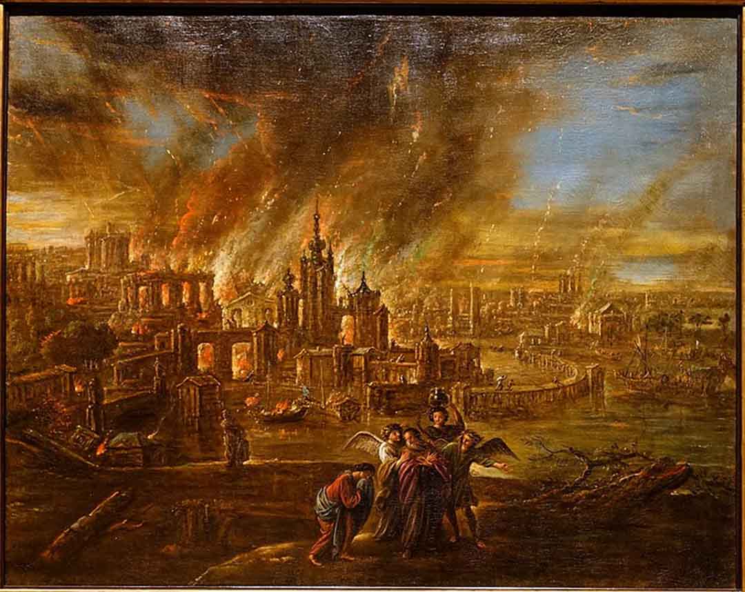
TOP PHOTO: Sodom and Gomorrah Afire by Jacob de Wet II, 1680. (credit: Daderot, Public domain, via Wikimedia Commons)
NOTE: Not every view expressed by scholars contributing Thinker articles necessarily reflects the views of Patterns of Evidence. We include perspectives from various sides of debates on biblical matters so that readers can become familiar with the different arguments involved. – Keep Thinking!


