SYNOPSIS:
The Biblical City of Ai Located and Matches Joshua’s Story – A key dispute in biblical archaeology has surrounded the location of the Conquest site of Ai. Did Joshua and the Israelites really conquer this city as the Bible claims? This update features the first of a two-part article by Scott Stripling and Mark Hassler that ran in Bible and Spade, Vol 31 No 2, Spring 2018. BIBLE and SPADE is a quarterly publication published by the Associates for Biblical Research.
So Joshua burned Ai and made it forever a heap of ruins, as it is to this day.
– Joshua 8:28 (ESV)
The Problem of Joshua’s Ai: Solved
After conquering Jericho, Joshua and the Israelites destroyed Ai, the second stronghold of the conquest (Jos 7–8). Everyone agrees on the location of Jericho, but the location of Ai continues to puzzle researchers. The issue garners attention because of its profound implications for biblical studies.
The debate over the location of Ai intertwines with the excavation of Jericho. Kathleen Kenyon excavated Jericho from 1952 to 1956. She concluded that the archaeological evidence at Jericho contradicts the biblical account. In 1961, Joseph Callaway studied with Kenyon in London and three years later, on behalf of the Southern Baptist Theological Seminary, began excavations at et-Tell, 10 mi (16 km) north of Jerusalem (the City of David). Et-Tell had long prevailed as the leading candidate for Ai because of the endorsement by W. F. Albright, the father of biblical archaeology and one of Callaway’s mentors. When Callaway ceased excavations in 1972, he concluded that et-Tell sat unoccupied at the time of the biblical conquest. Together, the interpretations of Kenyon, Callaway, and Albright eroded the evangelical belief in the inerrancy of Scripture.
In response to this erosion, David Livingston formed the Associates for Biblical Research (ABR) in order to investigate the “problem” of Ai. In a personal letter dated February 23, 1970, Albright assured Livingston that Ai belongs at et-Tell:
You can take it from me, and from Callaway and others, that there just isn’t any other possibility for Ai than et-Tell and that Bethel can only have been modern Beitin. Since 1921 we have examined and reexamined the whole countryside, and there just isn’t any archaeologically viable identification. 1
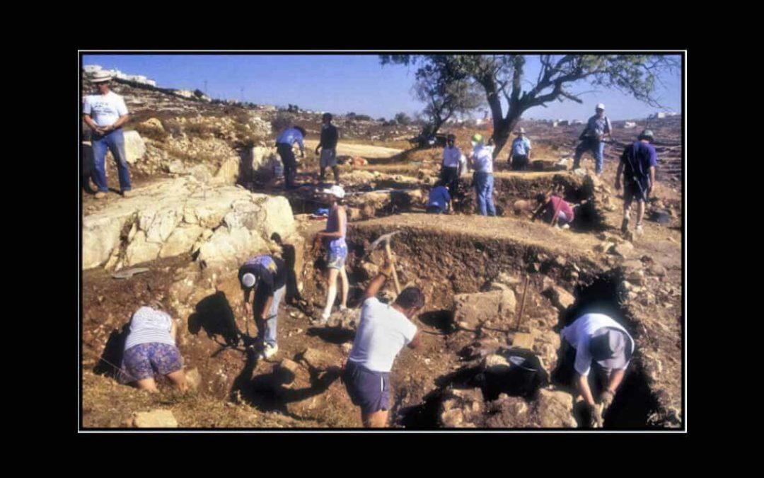
Undeterred, Livingston began excavations at Khirbet Nisya, his candidate for the Ai of Joshua 7–8 [photo at top of article]. He excavated there from 1979 to 2002, during which time he completed his doctor of philosophy degree at Andrews University. The findings at Khirbet Nisya illuminated the background of the Old and New Testaments, but a positive correlation with Ai proved allusive.
In 1994, ABR colleague Bryant Wood identified Khirbet el-Maqatir as another candidate for Ai, and the following year he launched excavations at the new site, 0.6 mi (1 km) west of et-Tell, and 10 mi (16 km) north of Jerusalem. Excavations continued at Khirbet el-Maqatir through 2016, with the final three years under the direction of Scott Stripling. Thus, from Livingston to Wood to Stripling, ABR has conducted excavations in search of Ai for nearly 40 years, 37 to be precise.
Various lines of reasoning allow for the possibility that the fortress of Ai in Joshua’s day stood at Khirbet el-Maqatir. For one, local tradition in the 1800s equated the sites.2 Moreover, a monastery from the Byzantine Age once graced the locale. The placement of the monastery seems deliberate in that monasteries often memorialized biblical events. Unfortunately, the excavation did not yield any mosaics or other clues as to what the monastery may have memorialized. Regardless, the geographical and archaeological indicators in Joshua 7–8 correspond to the evidence unearthed at Khirbet el-Maqatir. This study summarizes the correspondences and proposes a viable solution to the “problem” of Ai.
Geographical Indicators for the Site
The book of Joshua provides specific geographical indicators for the location of Ai. The geographical indicators appear as follows:
Strategic Location
When Joshua entered Cisjordan, he set into motion a brilliant military strategy: divide and conquer. The decision of where to divide the land was not arbitrary. It appears that he divided the land at a logical and strategic location—the Wadi el-Gāyeh, a west-east drainage, 10 mi (16 km) north of Jerusalem. The wadi formed a natural and political boundary between the southern territory governed by the city-state of Jerusalem and the central territory governed by the city-state of Shechem.3 Even after the conquest, the wadi functioned as the border between Benjamin and Ephraim (Jos 18:12–13). As Wood suggests, the military outpost there, visible from Jerusalem, guarded the northern border for the league of Amorites in the south (cf. 7:7; 10:1–6). On the north side of the wadi, just 1 mi (1.5 km) away, stood a fortress at Beitin, probably the southern border fortress for the Shechem league, says Wood. Khirbet el-Maqatir and et-Tell both sit near the southern embankment of the Wadi el-Gāyeh.
Near Beth-Aven

Joshua sent men from Jericho to Ai, which is near Beth-aven, east of Bethel, and said to them, “Go up and spy out the land.” And the men went up and spied out Ai.
– Joshua 2:7 (ESV)
Joshua locates Ai “near [ʿim] Beth-Aven” (Jos 7:2). The preposition ʿim designates general proximity, whereas the synonym ʾēt (near) signals immediate proximity. The most suitable locale for Beth-Aven is Beitin,4 a site often identified as Bethel. Khirbet el-Maqatir sits 1 mi (1.5 km) southeast of Beitin. Scholars who place Bethel at Beitin and Ai at et-Tell have yet to propose a feasible location for Beth-Aven. A feasible location must yield evidence of habitation at the time of the conquest.
Near and East of Bethel
The list of conquered rulers in Joshua 12 places Ai “near Bethel” (v. 9). The men of Bethel aided the men of Ai in their pursuit of the Israelites, a fact that confirms the proximity of the sites (8:17). Livingston and others situate Bethel at el-Bireh rather than the usual site of Beitin.5 A distance of 2.2 mi (3.5 km) separates Khirbet el-Maqatir and el-Bireh.
The Bethel equals Beitin formula has its drawbacks, two of which shall receive brief mention. First, the equation of Bethel and Beitin contradicts the idea that the fortress at Bethel served the Shechem alliance. If Bethel constituted el-Bireh, no contradiction exists because el-Bireh lies south of the Wadi el-Gāyeh, positioning it with the southern alliance. Second, the equation contradicts the work of Eusebius. As Rupert Chapman points out, “Eusebius’ statement that Gibeon was four miles west of Bethel is wholly incompatible with the currently accepted identification of Bethel with Beitin.”6
The fortress of Ai stood “east of Bethel” (Jos 7:2). The leading candidates for Ai, Khirbet el-Maqatir and et-Tell, both lie east of the leading candidates for Bethel, el-Bireh and Beitin.
Near and East of an Ambush Site
Prior to the battle, Joshua positioned his troops at an ambush site “not…very far from the fortress” (Jos 8:4). In 2015, three members of the ABR excavation team ran from the lip of the Wadi Sheban to the fortress gate at Khirbet el-Maqatir in only five minutes, while carrying backpacks.
The ambush site rested “behind” or “west” (ʾahar) of the fortress (vv. 2, 4, 14), that is, “between Bethel and Ai, west of Ai” (vv. 9, 12). The Wadi Sheban runs between el-Bireh and Khirbet el-Maqatir. This deep ravine could easily conceal numerous troops from watchers at Khirbet el-Maqatir or el-Bireh. The image below [looking south] shows the geographical relationship of the sites, with el-Bireh positioned to the right of the photo. Et-Tell, however, lacks an ambush site on the west. Israelite troops could have hidden behind the hill to the northwest, but the allies of Ai at Bethel (Beitin in this model) could have spotted them easily and blown their cover.

South of a Valley and Ridge
Joshua stationed soldiers “north of Ai” (Jos 8:11). And the very next statement explains, “There was a valley between him and Ai.” Khirbet el-Maqatir sits near the southern slope of a west-east valley, the Wadi el-Gāyeh. If the commander of Ai could see Joshua and his men in the valley, as verse 14 might imply, then the valley lacked depth. The bottom of Wadi el-Gāyeh is readily visible from Khirbet el-Maqatir.
The presence of a valley infers the existence of a ridge. Approximately 0.9 mi (1.4 km) north of Khirbet el-Maqatir, beyond the Wadi el-Gāyeh, stands Jebel Abu Ammar, the highest elevation in the area. It provides excellent visibility and a west-east ridgeline.
The geography and topography of Khirbet el-Maqatir meets the criteria revealed in Joshua 7–8. The discussion now shifts to the archaeological indicators.
Final Words From Patterns of Evidence: Biblical AI Located
Stay tuned for Part 2 of this article from Scott Stripling and Mark Hassler in the weeks ahead. Keep Thinking!
Endnotes
[1] W. F. Albright to David Livingston, February 23, 1970, in Khirbet Nisya: The Search for Biblical Ai, 1979-2002; Excavation of the Site with Related Studies in Biblical Archaeology, by David Livingston (Manheim, PA: Associates for Biblical Research, 2003), 263.
[2] Edward Robinson and Eli Smith, Biblical Researches in Palestine and the Adjacent Regions: A Journal of Travels in the Years 1838 and 1852, 3rd ed., vol. 1 (London: Murray, 1867), 448; E. Sellin, “Mittheilungen von meiner Palästinareise 1899,” Mittheilungen und Nachrichten des Deutschen Palaestina-Vereins 6 (1900): 1; Bryant G. Wood, “From Ramesses to Shiloh: Archaeological Discoveries Bearing on the Exodus–Judges Period,” in Giving the Sense: Understanding and Using Old Testament Historical Texts, ed. David M. Howard Jr. and Michael A. Grisanti (Grand Rapids: Kregel, 2003), 266.
[3] Bryant G. Wood, “The Search for Joshua’s Ai,” in Critical Issues in Early Israelite History, ed. Richard S. Hess, Gerald A. Klingbeil, and Paul J. Ray Jr. (Winona Lake, IN: Eisenbrauns, 2008), 237–38.
[4] Ibid., 228.
[5] Livingston, Khirbet Nisya, 177; Wood, “Joshua’s Ai,” 221.
[6] Rupert L. Chapman III, “Annotated Index to Eusebius’ Onomasticon,” in The Onomasticon by Eusebius of Caesarea: Palestine in the Fourth Century A.D., trans. G. S. P. Freeman-Grenville, indexed by Rupert L. Chapman III, ed. Joan E. Taylor (Jerusalem: Carta, 2003), 131.
TOP PHOTO: Khirbet Nysia excavations. Directed by David Livingston (upper left). (credit Michael Luddeni)
NOTE: Not every view expressed by scholars contributing Thinker articles necessarily reflects the views of Patterns of Evidence. We include perspectives from various sides of debates on biblical matters so that readers can become familiar with the different arguments involved. – Keep Thinking!


